
Central America (incl. Mexico)
The Central America Volcanic Arc is a chain of volcanoes which extends parallel to the Pacific coast line of the Central American Isthmus, from Guatemala, El Salvador, Honduras, Nicaragua, Costa Rica, and down to northern Panama. This volcanic arc, which has a length of 1,500 kilometres (930 mi), is formed by an active subduction zone along the western boundary of the Caribbean Plate.

Click for large image.
The notes of seconds/minutes above an image show the approx. auto-refresh time. - If you click on the sun button  on top of a webcam a clear weather image from that webcam will pop up to help you picture the lay of the land when the mountain is shrouded in dark clouds for days or weeks! on top of a webcam a clear weather image from that webcam will pop up to help you picture the lay of the land when the mountain is shrouded in dark clouds for days or weeks!
|

Santa Ana crater, El Salvador.
Learn more about these volcanoes at the Volcano Hotspot blog
Local time is for Mexico:
and for all other countries on this page
|
M E X I C O
|
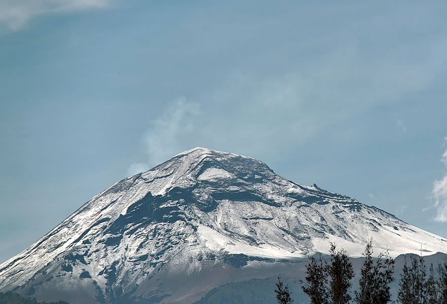
Mexico: POPOCATEPETL 1 O-Web 3 s. O-IMG


Volcán Popocatépetl from Tlamacas. - Also see webcams from Tianguismanalco and from Tochimilco if available.
|
Mexico: POPOCATEPETL 2 O-Web 15 s.
O-IMG

Volcán Popocatépetl from Altzomoni Tlamacas.
|
Mexico: POPOCATEPETL 3 O-Web 3 s. O-IMG

View from Tianguismanalco
|
Mexico: POPOCATEPETL 6 O-Web
O-IMG 15 s.
Webcams de Mexico. View from Amecameca. Also see from San Nicolás de los Ranchos Yesterday's time lapse video (new window) and LIVE stream on Webcams de Mexico.
|
|
Seismogram: station PPIG 15 min. O-Web O-IMG
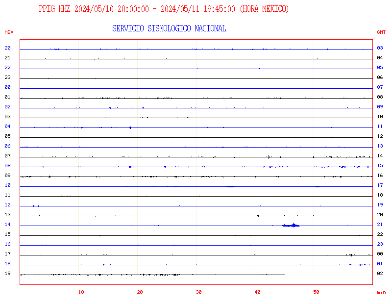
Seismogram for Popocatepetl, PPIG station.
|
Mexico: POPOCATEPETL 5 15 s. O-Web O-IMG
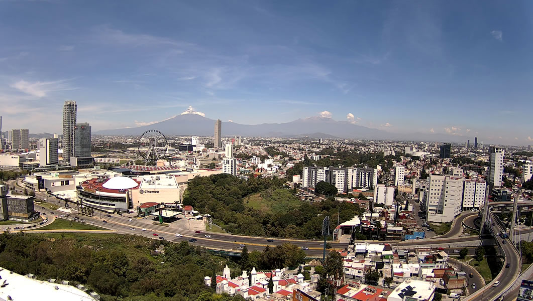
Popocatepetl with the town of Puebla. Webcams de Mexico.
|
|
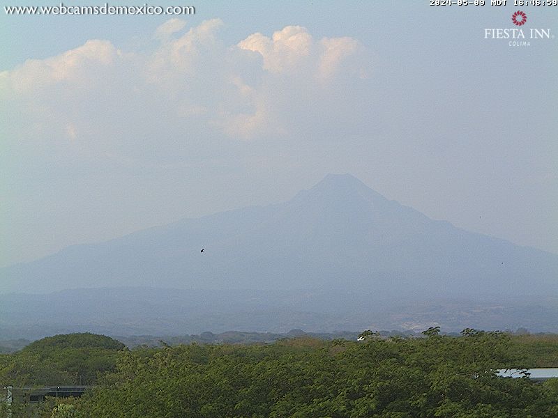
Mexico: COLIMA 1 O-Web O-IMG

Volcán de Colima, or Fuego de Colima, seen from Laguna de Carizalillo, roughly south of the volcano.
|
Mexico: COLIMA 2 O-Web O-IMG
View of the volcano from the city of Colima, Hotel Fiesta Inn.
|
|
Popocapetl
 |
Colima
 |
|
G U A T E M A L A
|
Guatemala: FUEGO 1 O-IMG 1 min. O-Web
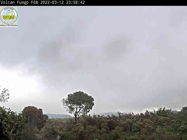
OVFUEGO webcam (7 km southwest of summit)
|
Guatemala: FUEGO 2 O-IMG 1min O-Web

La Reunion webcam (7 km southeast of summit)
|
Guatemala: PACAYA O-Web O-IMG
After being dormant for a century, it erupted violently in 1965 and has been erupting continuously since. During the past several decades, it had frequent strombolian eruptions with intermittent lava flow extrusion. |
Volcán de Fuego sits about 10 miles (16 km) from Antigua Guatemala and its elevation is 3763 m. It is famous for being almost constantly active at a low level. A small steam plume rises most of the time, but larger eruptions are rare. Last eruption began in September 2012, when the evacuees, roughly 33,000 people, left nearly 17 villages near the volcano. It erupted lava and generated pyroclastic flows
INSIVUMEH
Guatemala Seismograms
Santa María volcano: in the Pacific coastal plain of Guatemala and is 3772m high. Its "Santiaguito" lava-dome complex has been growing at the base of the 1902 crater since 1922. Dome growth has been accompanied by almost continuous minor explosions, with periodic lava extrusion, larger explosions, pyroclastic flows, and lahars. Last Eruption was in November 2012.
|
E L S A L V A D O R
|
El Salvador is a volcanically very active country, 90% of its territory are composed of volcanic materials. Geological investigations and field surveys determined that there exist 23 volcanoes and five volcanic fields in El Salvador. At present, only a few volcanoes have continued activity (outgassing and, exceptionally, ash) such as the Santa Ana (or Ilamatepec) volcano, the San Salvador Volcano, Volcano San Miguel (or Chaparrastique) and Izalco volcano.
LINKS
- MARNsv YT channel
- MARN volcano reports
- MARN: Active Volcanoes and Monitoring in El Salvador
- MARN: Monitoring Chaparrastique
- MARN on Twitter
- Volcanoes on SNET
- Seismograms
Volcán S. SALVADOR
O-Web 2min. O-IMG

|
El Salvador: Volcán Chaparrastique YouTube
Seismic Amplitude - Station San Miguel - last 2 days
(Change the last digit in the image URL for the number of days you want to be shown in the graph)

El Salvador: Volcán Ilamatepec YouTube
|
N I C A R A G U A
Nicaragua is surrounded by the Caribbean Plate, an oceanic tectonic plate underlying Central America and the Cocos Plate. Since Central America is a major subduction zone, Nicaragua hosts most of the Central American Volcanic Arc. Seismograms are available on the Ineter webseite; for volcanoes check Volcano monitoring stations and
Broadband stations. - For lots of interesting info and photos go to Xolo!
|
|
Nicaragua: MASAYA O-Web 5 min. O-IMG

View from Managua - Masaya is a 6 x 11 km basaltic caldera, last eruption was 2008 (VEI 1)
Another webcam view from the Mirador de Nandasmo.
Still photo 02/2016
|
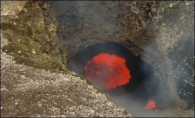
MASAYA Crater O-Web 5 min. O-IMG

Crater view, mostly obscured by steam and fumes.
MASAYA 3 3 min O-Web O-IMG

Lava lake Masaya crater, from viewing point II
|
|
Nicaragua: S. CRISTOBAL O-Web 5 min. O-IMG

From Unan-LEÓN. San Cristóbal volcanic complex consists of five principal volcanic edifices. Its youngest cone, named San Cristóbal (also known as El Viejo), is Nicaragua's highest volcano. Last of a series of small eruptions (VEIs 1 and 2) occured in 2013. |
Nicaragua: S. CRISTOBAL 2 O-Web 5 min. O-IMG

San Cristobal Volcano seen from Casita volcano, 5km ESE from the crater. S.C. was known in the last century as Volcán de El Viejo.
Wonderful 360° image from the volcano HERE!
|
|
Nicaragua: TELICA O-Web 1 min. O-IMG

|
Nicaragua: TELICA 2 O-Web 3 min. O-IMG

18 km N of Leon. Last eruption 09.05.2015
|
Nic.: MOMOTOMBO O-Web 2 min. O-IMG


View from seismic station El Cardon, 6 km ESE of the volcano, near the shore of Lake Managua. With many thanks to Volcano Discovery !!
|
Nicaragua: MOMOTOMBO 2 O-Web 5 min. O-IMG

View from the entrance to the Momotombo geothermal plant.
|
|
Nicaragua: MOMOTOMBO 3 O-Web 5 min. O-IMG

Young stratovolcano that rises prominently above the NW shore of Lake Managua. Last eruptios in 1905 (VEI 2) and since Dec. 2015. -- A fourth webcam, from Unan-LEÓN
|
Nicaragua: C. NEGRO
O-Web 5 min. O-IMG

View from Unan-LEÓN. Central America's youngest volcano, Cerro Negro, was born in April 1850 and has since been one of the most active volcanoes in Nicaragua. Last of a series of eruptions (VEIs 1 to 3) was 1999.
|
Nicaragua: CONCEPCION O-Web 5 min. O-IMG

Volcan Conception is on Ometepe island, in Lake Nicaragua. View from Hotel Charco Verde, 15km to the S of the volcano. Restless in May 2015.
|
Nicaragua: CONCEPCION 2 O-Web 5 min. O-IMG

View from Alcaldía Municipal de Altagracia, 5.7km NE of the volcano.
|
C O S T A R I C A
|
Costa Rica: TURRIALBA
O-web 10 sec.

Camera located at the craters of the Turrialba volcano, about 600 meters east of the active crater (looking west).
Magnificient panoramic photo of the three craters on Turrialba (an extinct crater to the right and the presently active one on the far left of the photo)
|
Costa Rica: TURRIALBA 2
O-IMG 10 sec. O-Web
With lines to help estimate the hight of ash plumes. |
Turrialba Seismograms (section of "Local Seismograms"). Refresh with F5.
O-IMG
Real-time seismograms of local stations on Turrialba. Showing the last six hours from left to right. Also a
Station Map and the Helicorders of Costa Rican volcanoes are provided on the OVSICORI-UNA website.
~
Check HERE for any live feeds on YouTube by RSNCostaRica.
|
|
Costa Rica: POÁS 1 O-Img 10 sec. O-Web
Cam located at the northern edge of the crater of Póas volcano.
|
Costa Rica: POAS 2 O-Web O-IMG
|
|
Costa Rica: Rincón de la Vieja 1
O-IMG O-Web
Camera located in Buenos Aires, Upala, ~7 km NNE of the volcano. |
Costa Rica: Rincón de la Vieja 2 O-Web O-IMG

WebCam CCFC image courtesy of Campbell Scientific Central America-Caribbean and Sensoria 'Land of Senses", ~3 km NNW of the volcano.
|