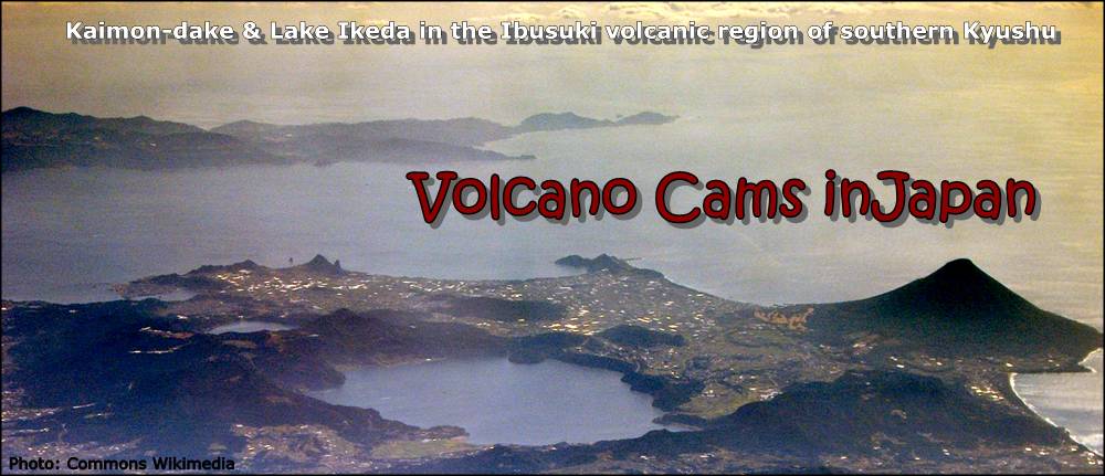
|
IWATESAN - O-IMG ? min. O-Web


Northern Honshu. The dominantly basaltic summit cone of Higashi-Iwate volcano, Yakushidake, is truncated by a 500-m-wide crater. It rises well above and buries the eastern rim of the caldera. A central cone containing a 500-m-wide crater partially filled by a lake is located in the center of the oval-shaped caldera. Latest (confirmed) eruption: July 1919
|
KUSATSU-SHIRANE O-IMG 1 min.
Honshu. All historical eruptions have consisted of phreatic explosions from the three acidic crater lakes or their margins. Fumaroles and hot springs that dot the flanks have strongly acidified many rivers draining from the volcano. The crater was the site of active sulfur mining for many years during the 19th and 20th centuries.
Last confirmed eruption 1983-07-26. |
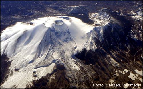
A S A M A Y A M A (Asama)
Central Honshu. The modern Maekake cone forms the summit and is situated east of the horseshoe-shaped remnant of an older andesitic volcano. It is probably only a few thousand years old. Maekake has had several major plinian eruptions, the last two of which occurred in 1108 (Asamayama's largest Holocene eruption) and 1783 CE. Last eruption: 2009-01-21, VEI 2.
Webcams: Maechan - Kitakaru - Sakuken - Sabo E - Sabo W - Komiyama (down) - Takasaki - Asama LIVE 1 and LIVE 2 (both on YT)
|
|
ASAMA 1 O-IMG 1 min.
O-WEB
View into the crater.
|
ASAMA 2 O-IMG 2 sec.
O-WEB
View from north of the volcano.
|
|
ASAMA 3 O-IMG 4 min.
O-WEB

Also from north.
|
ASAMA 4 O-IMG 1 min.
O-WEB
View from west of the volcano.
|
|
ASAMA 5 O-IMG 5 min.
O-WEB

Asama northeast by east 9.5km
|
Still image of Asamayama
|
|
|
HAKONEyama O-IMG 2 min. O-Web
Hakone, Region Kantō, 90 km SE of central Tokyo. Camera Owakudani Valley. On 30/06 and 01/07/2015 two small scale eruptions with some ash occurred here, otherwise only increased fumarolic activity was observed. Last eruption ~1100 AD.
|
ONTAKESAN O-Web 1 min. O-IMG

Ontakesan in SW Honshu, central Japan. It had a deadly VEI 3 phreatic eruption on 27 Sept. 2014. Before that, several small phreatic eruptions occured from 1979 on; no earlier eruptions were recorded. Many people ascend this volcano, often as a religious pilgrimage, as it is one of the more easily accessible.
|
A S O S A N (Aso)
Webcams for Mt. ASO are now on this separate page! |
|
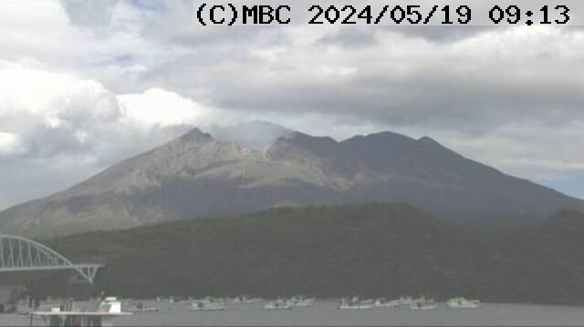
KIRISHIMAYAMA
Shinmoedake MBC /3 O-IMG 1 min.


Kyushu. Kirishimayama is a large group of more than 20 mostly andesitic volcanoes, covering an area of 20 x 30 km, with Shinmoedake to the NE. Frequent small-to-moderate explosive eruptions have been recorded since the 8th century. Last eruption 2011-01-19. Also see the rice field cam (mbc cam 1).
|
KIRISHIMA 2 MBC Cam 4 1 min.
View from Kirishima Kokubu Uenohara, south of the volcano. Movie of the last 2 hrs in a popup window.
On a separate page I have assembled the live streams that are presently running on YouTube: Live streams via YT page.
|
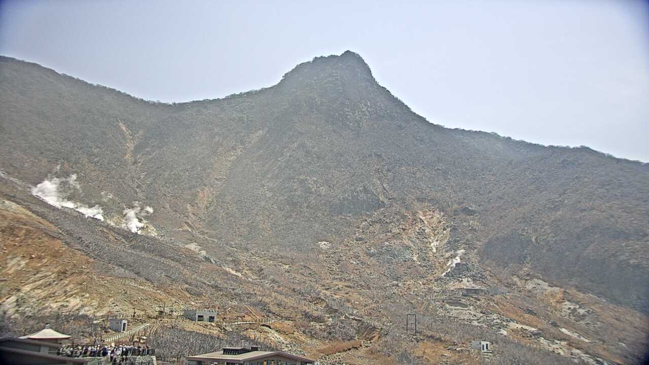
Ebino (Iozan) O-IMG 1 min. MBC/5

Iozan is the small hill on the left.
|
SAKURAJIMA
O-IMG 1 min. O-Web
Sakurajima from Tarumizu Ushinefumoto.
|
|
KUCHINOERABO-JIMA
O-IMG 2 min. O-Web
Several villages on the 4 x 12 km island are located within a few kilometers of the active crater and have suffered damage from eruptions. Last eruptive period started 2014-08-03.
|
KIKAI, Satsuma Iwo-Jima
O-IMG 2 min. O-Web
![Sorry, no connection.]()
Ryuku Islands. Kikai is a mostly submerged, 19-km-wide caldera. It was the source of one of the world's largest Holocene eruptions about 6300 years ago. Rhyolitic pyroclastic flows traveled across the sea for a total distance of 100 km to southern Kyushu, and ashfall reached the northern Japanese island of Hokkaido. The eruption devastated southern and central Kyushu, which remained uninhabited for several centuries. Historical eruptions have occurred in the 20th century at or near Satsuma-Iojima (also known as Tokara-Iojima), a small 3 x 6 km island forming part of the NW caldera rim. Mild-to-moderate explosive eruptions have occurred during the past few decades from Iodake, a rhyolitic lava dome at the eastern end of Tokara-Iojima.
|
 Tokyo time: Sakurajima page +++ Mt. Aso page